What Depth Can a Garmin Fish Finder Measure?
Anglers know that finding the right fishing spot is key, but what about knowing how deep it is?
Garmin fishfinders are popular tools for measuring underwater depth.
This article will dive into how these devices work and their range, so you can make the most of your next fishing adventure.
Read on to discover just how deep you can explore with a Garmin by your side.
Key Takeaways
- Garmin fish finders use advanced sonar technology to provide accurate depth readings, suitable for both saltwater and freshwater environments.
- These devices can measure a wide range of depths, enabling anglers to locate fish habitats and understand underwater structures more clearly.
- The high – sensitivity GPS feature in Garmin fishfinders improves navigation and helps fishermen mark and return to specific spots with ease.
- With the addition of water temperature sensors, Garmin’s tools offer real – time data that is crucial for finding and catching certain species of fish.
- Users can customize their Garmin fish finder displays by adjusting depth units to fathoms, meters, or feet according to personal preference or regional standards.
Understanding Garmin Fish Finders
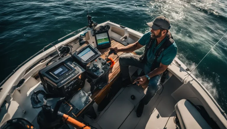
Moving beyond the basics, Garmin fishfinders are sophisticated tools that combine high-resolution sonar technology with detailed digital GPS maps. These devices use advanced sonar echoes to reveal what lies beneath the water’s surface, not just in terms of depth but also in identifying fish and underwater structures.
With a crisp display screen, users can view these details with remarkable clarity.
Garmin fish finders come equipped with intuitive menus and easy-to-identify icons, making it simple for anglers to navigate through different functions. The directional pad allows for quick scrolling through screens or settings.
Some models even include wi-fi connectivity, which enables seamless software updates and the sharing of spots or routes with other devices. Whether you’re charting unknown waters or tracking down your next catch, a Garmin fish finder is designed to be an essential piece of gear for any fishing enthusiast.
How Garmin Fish Finders Measure Depth?
Garmin fishfinders utilize sophisticated sonar technology to provide anglers with precise depth readings, enhancing their fishing experience by revealing what lies beneath the water’s surface.
These devices employ advanced sensors and algorithms, allowing for accurate depth measurements that inform strategic angling decisions.
Adjustable Depth Line
Adjusting the depth line on your Garmin fishfinder is a smart way to pinpoint exactly where you want to focus your fishing efforts. This feature allows you to set a specific depth and mark it directly on the screen.
With this line in place, identifying fish that swim at certain depths becomes simpler and more efficient. You don’t have to guess if the fish are close to the lake bottom or suspended midwater; the adjustable depth line shows you at a glance.
As you monitor changes in underwater landscapes with your chart plotter’s topographical maps, use this function to adapt quickly. It ensures precision when tracking down schools of fish or navigating towards favorable fishing spots while ice fishing or out at sea.
Moving seamlessly from one feature-rich tool to another enhances your angling experience without confusion. Next up, let’s delve into how water temperature sensors elevate your success on any body of water.
Water Temperature Sensor
Garmin fish finders are equipped with water temperature sensors that serve as a crucial tool for anglers. These sensors deliver real-time data on the water’s warmth, guiding users to spots where certain fish might be thriving, especially since some species have preferred temperature ranges.
This feature integrates seamlessly into Garmin’s sonar technology, ensuring fishermen have precise temperatures at their fingertips.
The ability to gauge water temperature not only improves the chances of locating fish but also helps in understanding their behavior and habitat preferences. As part of Garmin’s commitment to high-quality marine products, these sensors provide valuable information that can dramatically influence fishing success rates.
They offer much more than simple depth finders; they’re sophisticated tools designed to help you make smarter decisions on the water.
Depth Range Capabilities
Garmin fishfinders are engineered with advanced sonar technology, enabling anglers to explore the underwater world with precision and clarity. Delving into depth range capabilities, these devices reveal a stunning capacity to measure beneath the surface, whether surveying the azure expanses of oceanic saltwater or peering into the often murkier realms of freshwater lakes and rivers.
Saltwater Measurements
Saltwater challenges equipment with its corrosive nature and varying depths, but Garmin fishfinders are built to withstand these conditions. They feature advanced sonar technology that accurately gauges depth, no matter how salty the water is.
The STRIKER™ Vivid and ECHOMAP™ UHD series shine in these environments, offering clear readings to help anglers locate fish hiding spots deep below the surface.
The devices utilize GPS location data alongside their robust connectors to ensure seamless performance out on the open sea. This ensures fishermen can trust their readings for both shallow coastal areas and deeper off-shore locations.
Moving from saltwater measurements, let’s dive into freshwater capabilities and explore how Garmin adjusts to different aquatic environments.
Freshwater Measurements
Garmin’s fishfinders are engineered to deliver precise depth readings in freshwater environments, making them essential tools for anglers and boaters. These devices provide valuable information that helps users make informed decisions while navigating lakes, rivers, and reservoirs.
The technology behind these marine products thrives under the conditions of freshwater bodies, ensuring performance remains consistent and reliable.
For those who enjoy freshwater fishing or boating, Garmin fish finders offer a clear advantage by pinpointing the depth accurately. This functionality is critical for locating fish habitats and understanding underwater structures where fish might be hiding.
With robust construction designed specifically for freshwater use, these devices withstand the elements while providing fishermen with the insights they need to have a successful day on the water.
Special Features of Garmin Fish Finders
Garmin fishfinders are not just depth-sensing devices; they’re equipped with innovative functions that enhance fishing efficiency and navigation. These tools come integrated with advanced technology designed to optimize your angling experience, whether you’re in familiar waters or exploring uncharted territory.
High-sensitivity GPS
The high-sensitivity GPS included with Garmin fish finders takes precision to the next level, especially crucial when you’re on a vast lake or out in the deep sea. As your trusty navigational aid, this feature maintains an accurate location even in heavy cover or deep canyons.
With pinpoint accuracy, it helps anglers mark and return to hot spots, ramps, and docks without any guesswork.
This advanced GPS capability isn’t just about getting there; it enhances your fishing experience by integrating seamlessly with detailed maps and sonar data right on your screen. Whether you’re plotting a course or tracking fish schools, the reliable satellite connection keeps you oriented and informed at all times—vital for successful outings where every detail counts.
Built-in Flasher
Garmin fishfinders stand out with their built-in flasher technology. This feature is crucial for anglers who demand real-time sonar data to make quick and informed decisions on the water.
As your lure sinks, the flasher reveals its descent and shows you exactly when it reaches the fish zone. You can watch schools of fish react, interact with structures beneath your boat, and even detect bait movement.
Offering both durability and precision, Garmin’s advanced sonar capabilities through the built-in flasher are designed to withstand tough marine environments while providing clear underwater details.
Anglers get a live view that helps them hone in on targets and enhances their chances for a successful catch, whether fishing in freshwater or braving the sea’s salty waves. Next up: entering coordinates accurately into your Garmin device elevates your fishing game to new depths!
Entering Coordinates in Garmin Fish Finders for Accurate Depth Measurement
Garmin fishfinders are valuable tools for locating underwater features and assessing depth with precision. To utilize this technology effectively, anglers must know how to input coordinates accurately.
- Power on your Garmin device and access the main menu to start the process.
- Select ‘Waypoint Manager‘ or ‘Coordinates‘ from the menu options, depending on your model.
- Use the keypad or touchscreen interface to input the latitude and longitude of your desired location.
- Make sure you set the correct format for the coordinates, which might be in degrees, minutes, and seconds (DMS) or decimal degrees (DD).
- Confirm the entered coordinates by cross – referencing them with a reliable source such as a marine chart or digital GPS map.
- Save the new waypoint; this allows you to navigate back to this precise spot whenever necessary.
- Once saved, select ‘Navigate‘ if you wish to start fishing immediately at that location; your Garmin will guide you there using its high-sensitivity GPS function.
Adjusting Depth Units on Garmin Fish Finders
Garmin fish finders offer the flexibility to adjust depth units to fathoms, meters, or feet, allowing anglers to tailor their displays for optimal understanding and efficiency based on their preferences and regional standards—discover how this feature enhances your fishing expeditions.
Setting to Fathoms
Garmin chartplotters and fishfinders offer flexibility in how you view depth measurements, including the option to display depths in fathoms. Fathoms are especially useful for experienced anglers or mariners who think in terms of this nautical measurement.
Switching to fathoms is straightforward on these devices; simply navigate through the settings menu and select ‘Fathoms’ as your preferred depth unit.
The ability to change units ensures that you can tailor your Garmin device to fit any fishing situation or personal preference—whether that’s feet, meters, or fathoms. With your choice locked in, you’re ready to explore new waters with confidence and precision.
Next up, we’ll look into “Special Features of Garmin Fish Finders,” where high-sensitivity GPS and built-in flasher functionalities take center stage.
Conclusion
Discover the depths of your favorite fishing spots accurately with a tool designed for precision. Uncover what lies beneath the waves as Garmin fish finders present detailed measurements, whether in shallow streams or deep sea environments.
Experience ease and efficiency on all your aquatic adventures, thanks to innovative technology tailored for anglers. Dive into a world where uncovering hidden underwater landscapes becomes second nature.
Chart new territories and fish with confidence, knowing exactly how deep you’re casting your line.
For detailed guidance on inputting your fishing location data, check out our comprehensive tutorial on how to enter coordinates in Garmin fish finders.
FAQs on Garmin Fish Finder Depth Measurement Capability
Gary Burrell
Born in 1989, Gary Burrell is an Electrical Engineering graduate from the University of Tennessee. With 20+ years of experience, he has transitioned from engineering roles to becoming the Chief Content Editor. Gary’s unique blend of technical knowledge and editorial expertise has made him an essential figure in content creation, ensuring clarity and accuracy. His journey from an engineer to an editor showcases his adaptability and commitment to continuous learning.


