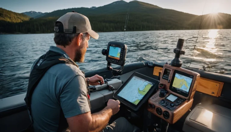
Do Garmin Fish Finders Come With Maps?
Finding fish beneath the waves can feel like searching for treasure without a map.
Thankfully, Garmin fishfinders are equipped with detailed maps to guide your aquatic adventures.
In this post, we’ll reveal how these devices use nautical charts and cutting-edge technology to enhance your fishing experience.
Keep reading to discover a sea of information just waiting beneath the surface!
Key Takeaways
- Garmin fishfinders come with integrated maps and nautical charts, providing detailed coastal and inland waterway information that’s essential for navigation and successful fishing.
- Many models include a one-year subscription to Garmin Navionics+ or Vision+, offering users daily chart updates, high-resolution relief shading, and satellite imagery when compatible.
- Compatibility with a wide range of transducers means you can get accurate underwater images and depth readings; models like the ECHOMAP series are designed to connect easily with various Garmin transducers.
- Features like Auto Guidance+ suggest safe dock-to-dock routes by taking into account potential navigational obstacles, enhancing safety on the water.
Overview of Garmin Fish Finders
Garmin fishfinders epitomize advanced angling technology, offering an array of features that cater to both novice and experienced fishermen. They’re designed not just to locate fish but also to enhance the overall fishing experience with their superior functionality and user-friendly interfaces.
Features and Functionality
Garmin fishfinders pack a powerful punch with cutting-edge technologies designed to enhance your fishing adventures. High-sensitivity GPS locks onto your position swiftly, ensuring you can track your movements with precision.
Depth range shading allows anglers to easily view the depth zones up to a certain range, while shallow water shading marks areas too risky for navigation. Auto Guidance+ technology steps up your game by suggesting the best dock-to-dock routes, making tricky channels and marina entrances less daunting.
The integration of Garmin and Navionics content brings unparalleled clarity to marine charts and maps, showcasing detailed coverage that extends from coastal zones to inland waters.
Features like raster cartography add another layer of richness to maps, offering traditional paper chart-like views for a familiar reference as you explore new or known waters. With feedback and insights from the ActiveCaptain community, users gain access not only to valuable points of interest but also local tips and experiences shared by fellow boaters and anglers—all at their fingertips thanks to these innovative Garmin chartplotters.
Garmin Fish Finders and Mapping Capabilities
Garmin’s fish finders are not just adept at locating your next big catch but also come equipped with advanced mapping capabilities designed to enhance your fishing strategy—discover how these systems can chart a course for success on the water in the rest of our discussion.
Inclusion of nautical charts and fishing maps
Garmin fishfinders stand out with their integrated nautical charts and fishing maps, a crucial aid for any angler or sailor looking to navigate waters safely and effectively. The company’s partnership with Navionics enriches its devices with comprehensive cartography that includes detailed shoreline contours, depth markings up to 1-foot increments, and regular updates to ensure the most current information is at hand.
With tools like Auto Guidance+ technology, users receive smart dock-to-dock route suggestions that factor in obstacles such as channels and marina entrances.
Users also benefit from an included one-year subscription upon purchase of new Garmin Navionics+ or Vision+ products. This opens the door to daily chart updates along with layers of extra content like high-resolution relief shading and satellite imagery when compatible, enhancing adventures on the water.
Leveraging insights from ActiveCaptain community contributions further augments mapping utility by adding local points of interest and experiences shared by fellow enthusiasts. Next, we explore how Garmin transducers complement these sophisticated fishfinder systems for optimal performance.
Compatibility of Garmin Transducers with Fish Finders
Matching the right transducer with your Garmin fish finder is crucial for getting clear underwater images and accurate depth readings. The good news is that most Garmin transducers are designed to be highly compatible across a range of fishfinders.
This means anglers can upgrade or replace their devices without worrying about purchasing new transducers each time. For instance, models like the ECHOMAP series come ready to connect with a variety of Garmin transducers, offering versatility and ease of use.
When it comes to installation, you can mount these high-performance sensors on the hull, through the hull, or on the trolling motor, depending on your boat’s design and fishing needs.
It’s essential to choose a model that fits not only your fishfinder but also your vessel type for optimal performance. Whether you’re navigating coastal waters with BlueChart g3 charts or exploring inland lakes using LakeVü g3 maps, having a compatible transducer helps ensure successful outings by providing detailed sonar feedback in real-time.
Specific Garmin Models with Map Features
Discover how certain Garmin models, like the advanced ECHOMAP UHD2 64sv Chartplotter/Fishfinder Combo, are equipped with sophisticated map features designed to enhance your fishing expeditions—delve deeper to unveil the full capabilities of these innovative devices.
ECHOMAP UHD2 64sv Chartplotter/Fishfinder Combo
Unlock the full potential of your fishing expeditions with the ECHOMAP UHD2 64sv Chartplotter/Fishfinder Combo. This high-tech device comes equipped with a GT54 transducer, offering anglers clear and detailed sonar imagery.
With built-in Navionics+ US Coastal and Great Lakes Charts, you won’t miss a hotspot or hidden underwater structure. It features high-resolution relief shading and satellite imagery to give you an almost real-life view beneath your boat.
The combo’s advanced tools cater to every angler’s needs: depth range shading helps identify target depths, while shallow water shading warns of areas too risky for your vessel’s draft.
Enjoy unparalleled navigation thanks to Auto Guidance+ technology that plots the safest course from dock to dock. Next on our list is understanding how these innovative devices fit in with private sales events and new product launches. Stay tuned for insights into maximizing your investment!
Conclusion
Exploring the deep waters just got easier with Garmin fishfinders. You’ll navigate confidently, knowing detailed maps and charts are at your fingertips. Trust in high-tech guidance to steer you through uncharted territories and local hotspots alike.
With Garmin’s mapping capabilities, every fishing adventure becomes a journey of discovery—no second-guessing is required. Sail away with the assurance that beneath your vessel lies a world perfectly mapped out for your aquatic pursuits.
FAQs on Garmin Fish Finder Maps Inclusion
Gary Burrell
Born in 1989, Gary Burrell is an Electrical Engineering graduate from the University of Tennessee. With 20+ years of experience, he has transitioned from engineering roles to becoming the Chief Content Editor. Gary’s unique blend of technical knowledge and editorial expertise has made him an essential figure in content creation, ensuring clarity and accuracy. His journey from an engineer to an editor showcases his adaptability and commitment to continuous learning.


